MAP- 2026
Thalayazham Grama Panchayat – Constituency Delimitation Report
Introduction
In accordance with the provisions of the Kerala Panchayat Raj Act, 1994, the Kerala Delimitation Commission has carried out the re-determination of constituencies in Thalayazham Grama Panchayat and issued the final order. The ward delimitation has been undertaken with the objective of making the democratic election process to local self-government institutions more effective and ensuring proper representation of the people.
Administrative Background
Following the decision to fix the number of members to be elected through direct election in Thalayazham Grama Panchayat at 16, the process of dividing the Grama Panchayat into 16 constituencies was initiated. A draft notification was published, and objections and suggestions were invited from the public. After examining the complaints and recommendations received and conducting public hearings, the final order was issued.
Ward Delimitation
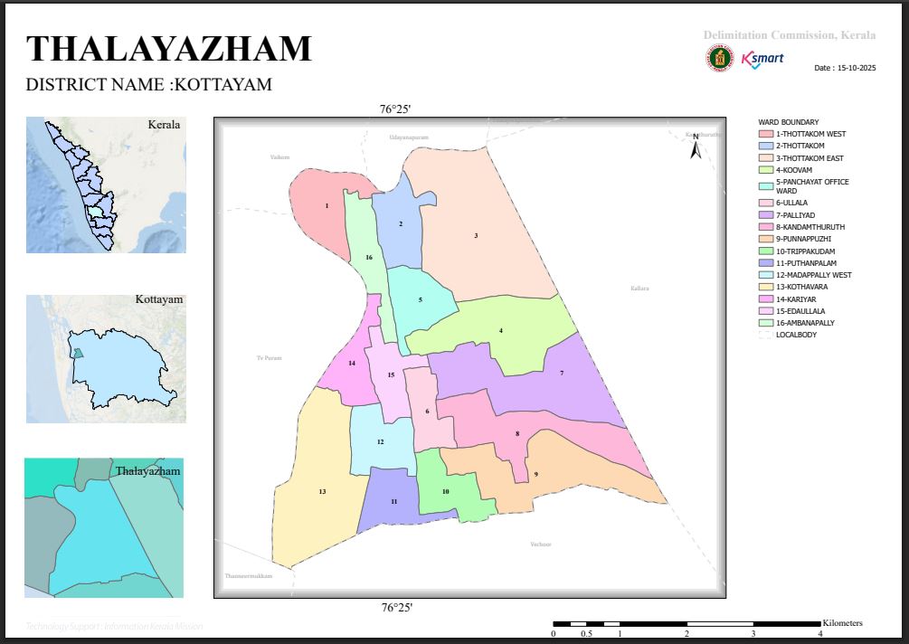
As per the final notification, Thalayazham Grama Panchayat has been divided into the following 16 wards:
- Thottakom West
- Thottakom
- Thottakom East
- Koovam
- Panchayat Office Ward
- Ullala
- Palliyad
- Kandamthuruthu
- Punnappuzhi
- Thrippakkudam
- Puthenpalam
- Madappally West
- Kothavara
- Kariyar
- Idaya Ullala
- Ambanappally
Population Analysis
The population of each ward ranges approximately from 1,194 to 1,376. This relatively balanced distribution of population helps ensure equitable representation across the different areas. Efforts to minimise variations in population between wards contribute to strengthening democratic values and fair representation.
Geographical Features
While determining the boundaries of the wards, natural and locally identifiable boundaries have been given primary consideration. Vembanad Lake, Kariyar, K.V. Canal, various streams, rural roads, and major transportation routes have been used as important reference points for determining the boundaries. This helps ensure administrative clarity and convenience in conducting elections.
Significance
The new ward delimitation ensures equitable representation for all areas within the Grama Panchayat and creates better opportunities for conveying the needs of the people effectively to the local administration. The delimitation is also expected to support people's participation, efficient implementation of development projects, and balanced utilisation of resources.
Conclusion
The ward re-delimitation carried out by the Kerala Delimitation Commission is expected to further strengthen the democratic governance system of Thalayazham Grama Panchayat. The 16 wards, formed taking into consideration population, geographical characteristics, and administrative convenience, are expected to provide a strong foundation for the overall development of the Grama Panchayat and efficient local governance.